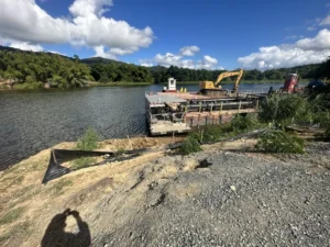
Restoring Vital Water Capacity: The Loíza Lake (Carraízo) Dredging Project
The Loíza (Carraízo) Reservoir is the lifeline of the San Juan Metropolitan Area, supplying drinking water to hundreds of thousands…
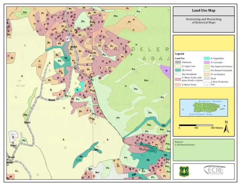
In the lush landscapes of Puerto Rico lies a treasure trove of history—maps from the 1950s that reveal how rural lands were once used. These documents, however, were locked away in fragile, fading paper, making them difficult to access, analyze, and apply to modern-day planning.
A Race Against Time
The project began in March 2023 when ECR Engineering was awarded a contract through a competitive bidding process from the USDA Natural Resources Environment Forest Service. The mission was clear: preserve, digitize, and transform historical land use data into a powerful digital resource. The challenges were many—damaged and incomplete maps, inconsistent scales and details, the painstaking process of historical georeferencing, and the complexity of merging multiple sources into one cohesive mosaic. Each map required meticulous manual vectorization, advanced GIS techniques, and seamless integration with modern geospatial systems.
Innovation in Action
Using advanced software such as ArcGIS 10.8 and ArcGIS Pro, the team brought these maps into the digital age. The process involved scanning, georeferencing, vectorizing, and mosaicking hundreds of historical sheets, correcting distortions, and aligning them with today’s coordinate systems.
Impact Beyond the Project
With an investment of $30,000, the project has opened unprecedented access to historical data. Researchers, students, and the public can now explore Puerto Rico’s rural landscapes from the 1950s. Educational institutions have gained a rich resource for teaching geography, environmental history, and land planning. For the USDA and its state partners, this geospatial database provides a foundation for better decision-making in conservation, restoration, and forest management. Programs like Forest Legacy and Forest Stewardship can identify priority areas and justify actions with historical evidence. The maps now also serve as a guide for urban green infrastructure planning, helping design ecological corridors, reforestation zones, and resilient green spaces.
Recognition
The project’s success led to an invitation to co-author a publication detailing the results of the vectorization of Puerto Rico’s Rural Land Classification Program historical maps—cementing its value for both science and heritage.